SkyVue’s Aerial LiDAR and airport obstacle evaluation
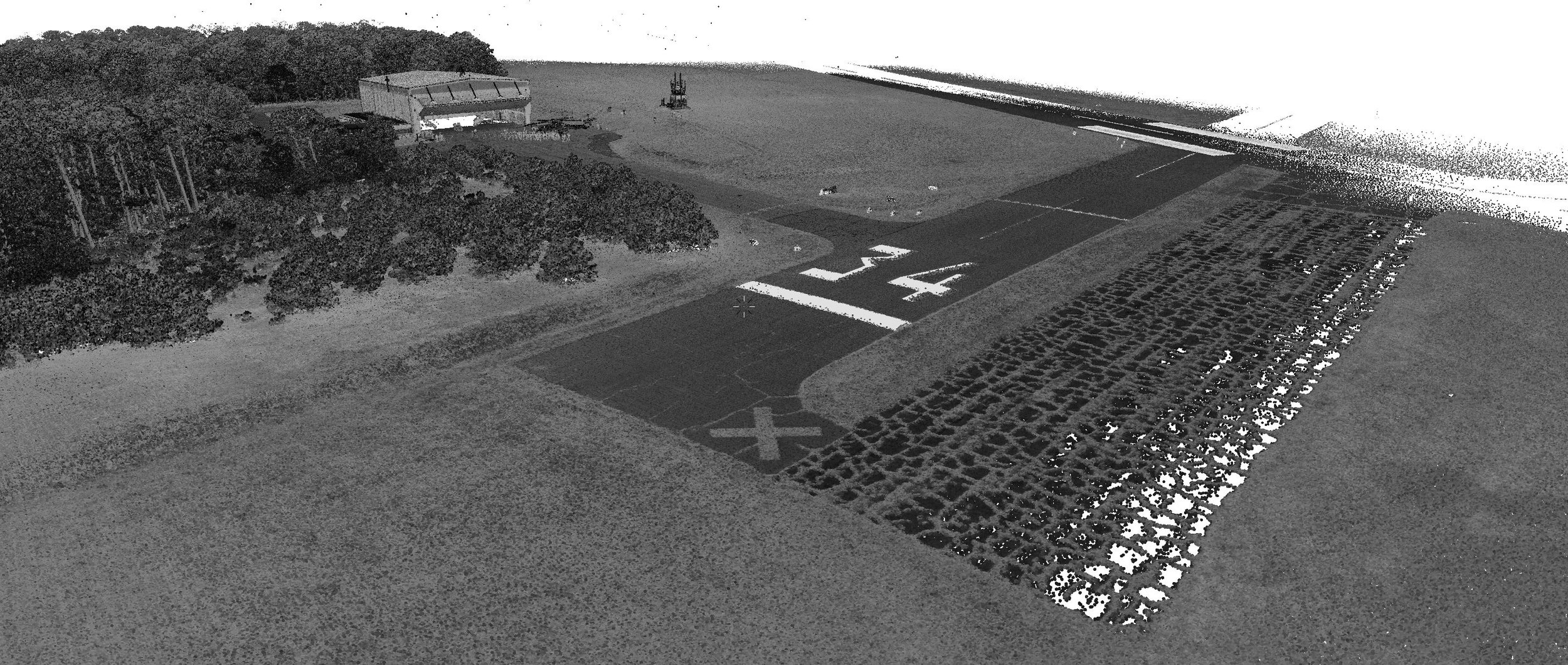
Aerial lidar can be a powerful tool for airport obstacle evaluation, providing detailed 3D data that can be used to identify potential hazards. When used in conjunction with other data sources, such as aerial photography and GIS data, it can provide a comprehensive picture of the airport environment.
The first step in using lidar for airport obstacle evaluation is to ensure that the data is accurately calibrated and geo-referenced. This can be done using ground control points, which are points on the ground whose locations are known with a high degree of accuracy. Once the data is accurately calibrated, it can be used to create a digital elevation model (DEM) of the airport environment.
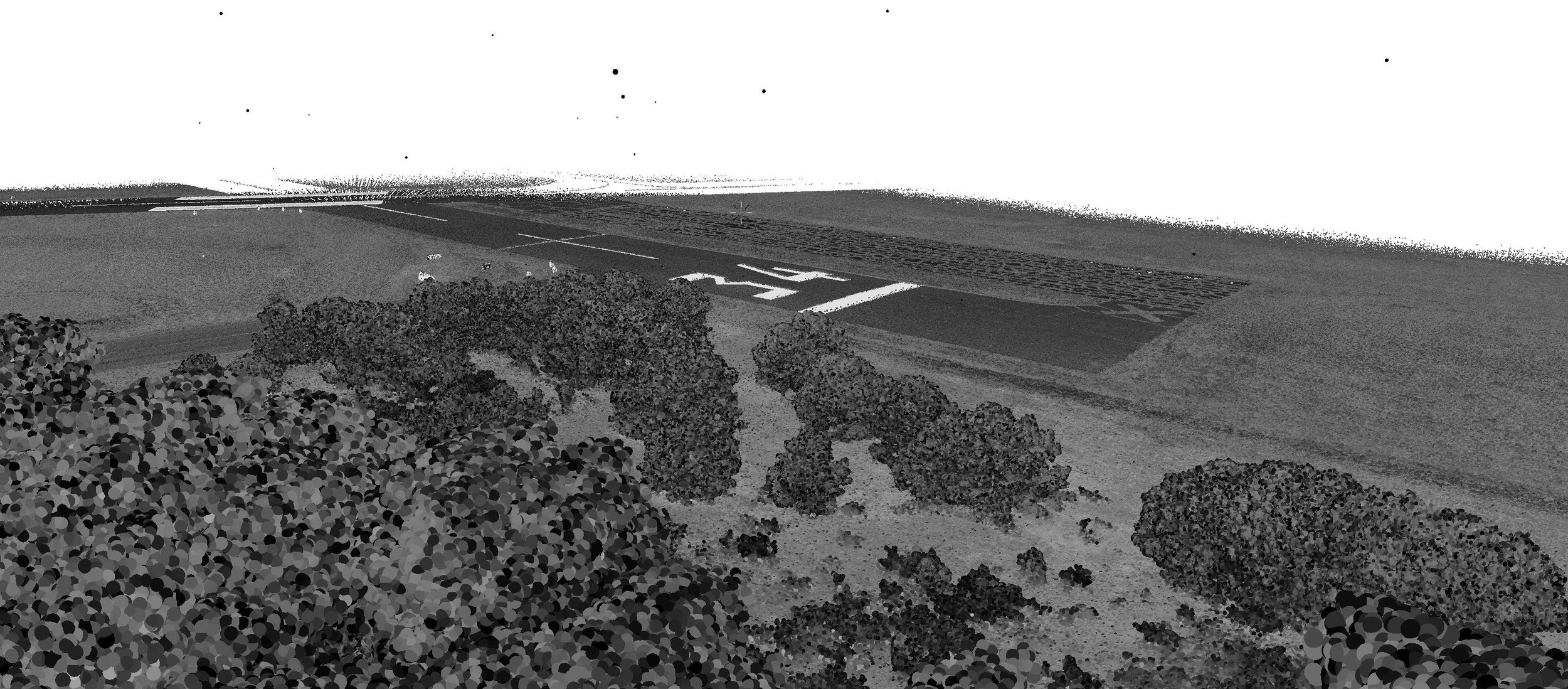
The second step is to process and interpret the lidar data in a way that takes into account the specific characteristics of the airport environment. One way to do this is to use point cloud filtering software to extract only the data points that are within the airport boundaries. This ensures that only relevant data about the airport is considered.
Once the lidar data has been processed and interpreted, it can be integrated into a comprehensive airport planning and management system. This system can be used to track changes to the airport environment over time, identify potential hazards, and develop mitigation and response plans.

The best part is that this work can be completed in a matter of hours, saving money, time, and backend obstacle measurement calculations. Better yet, SkyVue’s accuracies are < 1/10th of a foot!
SkyVue is a service provider, and we look to be a tool for you to use on your next project. Learn more about SkyVue LiDAR Here